

LiDAR drones have changed how India surveys land, mines, corridors and infrastructure, but choosing one is harder than it looks. A LiDAR sensor is only one payload on the aircraft, and the drone you pick has to stay useful across every job you fly, not only your first terrain survey.
This guide compares five DGCA-certified LiDAR drones available in India, explains what each does best, and shows why the Indrones Sigma100 is our top pick for teams that need one aircraft to do more than scan.
What are LiDAR drones, and how do they work?
LiDAR drones are unmanned aircraft carrying a laser scanner (LiDAR stands for Light Detection and Ranging). The scanner fires laser pulses at the ground and measures how long each one takes to return. Combined with GNSS and inertial data, those measurements become a dense 3D point cloud of terrain, structures, and vegetation.
Two properties make LiDAR drones valuable in India’s varied landscapes:
- They can capture ground under vegetation. A single pulse can return several echoes, so part of the signal reaches the ground through the tree canopy. Matching the sensor to the aircraft matters, and buyers should consider point density, navigation accuracy, detection range, vegetation penetration, and payload weight.
- They deliver measurable 3D data directly. Typical uses include surveying, infrastructure mapping, utility corridors, environmental monitoring and construction site documentation.
Why DGCA type certification matters for LiDAR drones
Except for nano and model drones, every drone needs a DGCA type certificate, issued under the Certification Scheme for Unmanned Aircraft Systems developed with the Quality Council of India. An accredited certification body assesses documents and runs tests, including flight tests, before DGCA issues the certificate. Drones without a valid Type Certificate cannot obtain UIN registration.
In practice, a type-certified LiDAR drone lets you register the aircraft, insure it, and meet tender requirements. One detail is often missed: the certificate covers a specific model and its listed payloads. Always ask which payloads are certified and which are only “compatible.”
How to choose a LiDAR drone: four questions
- How many missions can one certified airframe cover? A LiDAR drone that only scans sits idle between scanning jobs.
- How long does it fly with a real payload? Endurance sets how much ground you cover per battery set.
- Which payloads does the certificate cover? This decides what you can fly without extra compliance questions.
- What sits behind the aircraft? Training, spares, software, and track record matter as much as the spec sheet.
The 5 best LiDAR drones in India
1. Indrones Sigma100: the multi-mission LiDAR drone
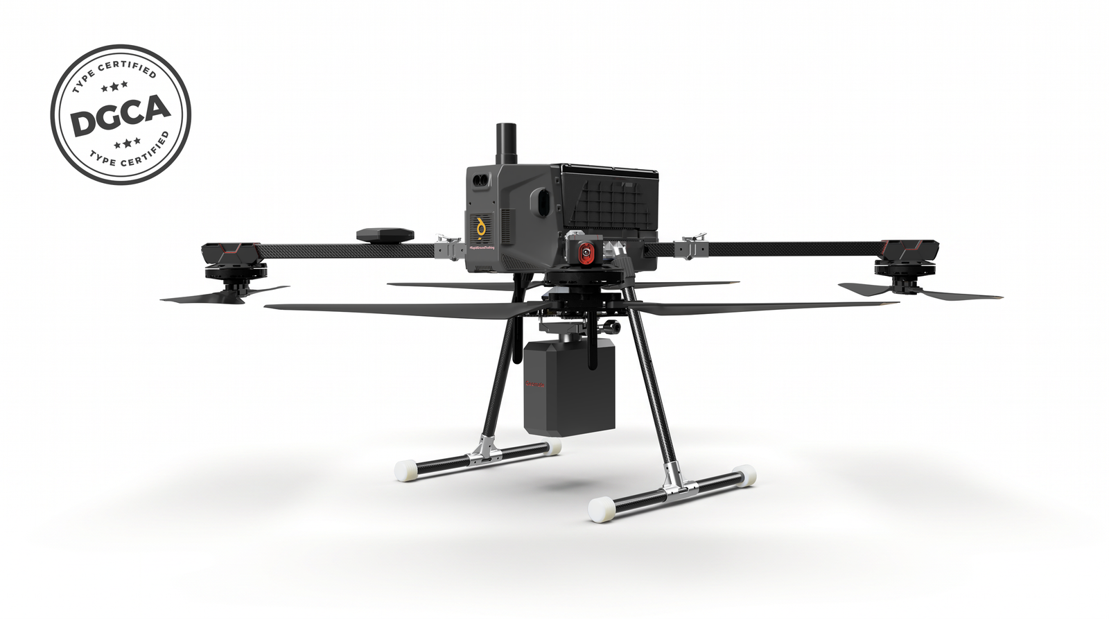
The Sigma100 Drone is an enterprise-grade multi-mission platform built for demanding industrial applications. It delivers up to 75 minutes of maximum flight time and a 5 km operational range.
Best for: teams that want one certified aircraft for LiDAR, survey mapping, 3D oblique and zoom inspection.
The certificate. DGCA issued Type Certificate No. T09260000124/00 for the Sigma 100 to Indrones Solutions Private Limited on 25 September 2026, on the recommendation of TQ Cert Services Private Limited. It remains valid until suspended or cancelled.
| Specifications | Sigma100 |
| DGCA category | Small |
| Maximum take-off weight | 8.1405 kg |
| Flight time | Up to 63 minutes |
| Battery | 40,000 mAh Li-ion |
| Operational range | 2 km |
| Wind resistance | Up to 12 m/s |
| Operating altitude | 400 ft AGL |
| Temperature | 10°C to 50°C |
Certified payloads: LiDAR, 24 MP RGB survey camera, penta oblique camera for 3D models, and an RGB surveillance camera with up to 30x zoom.
Other compatible payloads: radiometric thermal imager with zoom, 5-band multispectral/NDVI, and any payload up to 1.5 kg.
Why the Sigma100 stands out among LiDAR drones
It covers four mission types under one certificate. Most LiDAR drones are strong at one or two jobs. The Sigma100’s certificate spans LiDAR for terrain and structures, a 24 MP survey camera for orthomosaics, a five-angle oblique camera for 3D models, and a 30x zoom camera for inspection and observation.
It has the longest published endurance in this comparison. Indrones quotes up to 63 minutes, compared with about 45 minutes quoted by ideaForge and Latrics for their multirotors. Endurance depends on payload and conditions, so ask for the figure with your LiDAR fitted. Even so, more minutes per sortie means fewer battery swaps and fewer relaunches.
It turns idle days into billable days. A single-purpose LiDAR drone has no work between scanning jobs. A Sigma100 team can switch to a 3D oblique capture, an orthomosaic or a zoom inspection on the same aircraft, with the same pilots, batteries and compliance paperwork.
It has headroom for the unexpected. Beyond the certified payloads, it accepts thermal, multispectral and custom sensors up to 1.5 kg, which helps when an oil and gas, mining or utility client changes the brief mid-project.
It comes from an operator-led manufacturer. Indrones deliver geospatial intelligence for oil and gas, mining, power and infrastructure, using drones and computer vision. Its sibling Sigma25G reports more than 5,000 flight hours, over 300 projects and operations across 15+ states.
Where it is not the right tool. The published range is 2 km, so it suits site-based and line-of-sight corridor work. For very large areas, a fixed-wing like the Trinity F90+ covers more ground per flight, and custom payloads are limited to 1.5 kg.
2. ideaForge Q6 V2 GEO: enterprise LiDAR drone
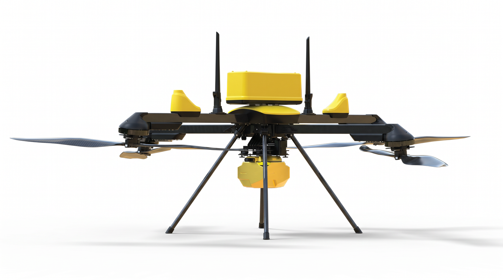
IdeaForge received DGCA Type Certification for the Q6 V2 GEO in May 2026, in the Small category. It supports LiDAR, LiDAR with RGB, high-resolution photogrammetry, 3D oblique and dual day/night payloads, with up to 45+ minutes of flight time. It comes with cloud software for processing orthomosaics, point clouds, and 3D terrain models.
Best for: large enterprises and government buyers who want an established OEM and a bundled software stack.
Versus the Sigma100: endurance is shorter, and its listed configurations do not include multispectral or a zoom surveillance payload.
3. Trinity F90+: fixed-wing LiDAR drone for large areas
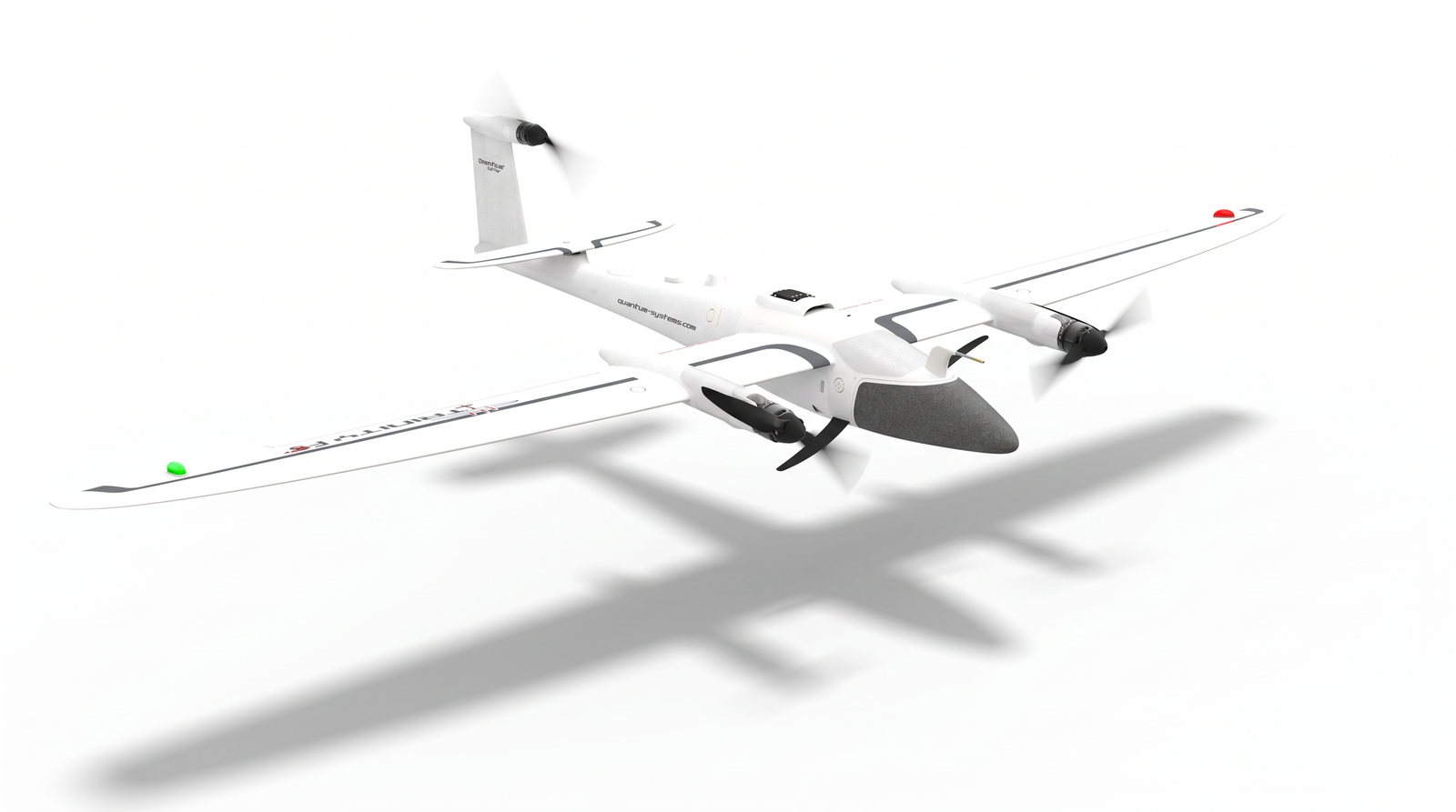
Built by Quantum Systems and offered in India through the Roter Group. Roter described it as the first fixed-wing eVTOL in the Small category to receive DGCA certification, and the same drone was procured by Survey of India for the Swamitva mapping programme. Roter says it later received DGCA Type Certification, with a LiDAR sensor among the certified payload configurations. With the Qube 240 LiDAR, it flies up to 60 minutes and records accuracy below 3 cm at a suggested 100 m AGL.
Best for: highways, canals, transmission corridors, and large leases where coverage per flight is the priority.
Versus the Sigma100: it needs room to transition and land and is less suited to tight sites, slopes, or hover-and-inspect work. It is a mapping specialist, while the Sigma100 is a multirole platform.
4. Latrics LiCopter P720: LiDAR-first multirotor
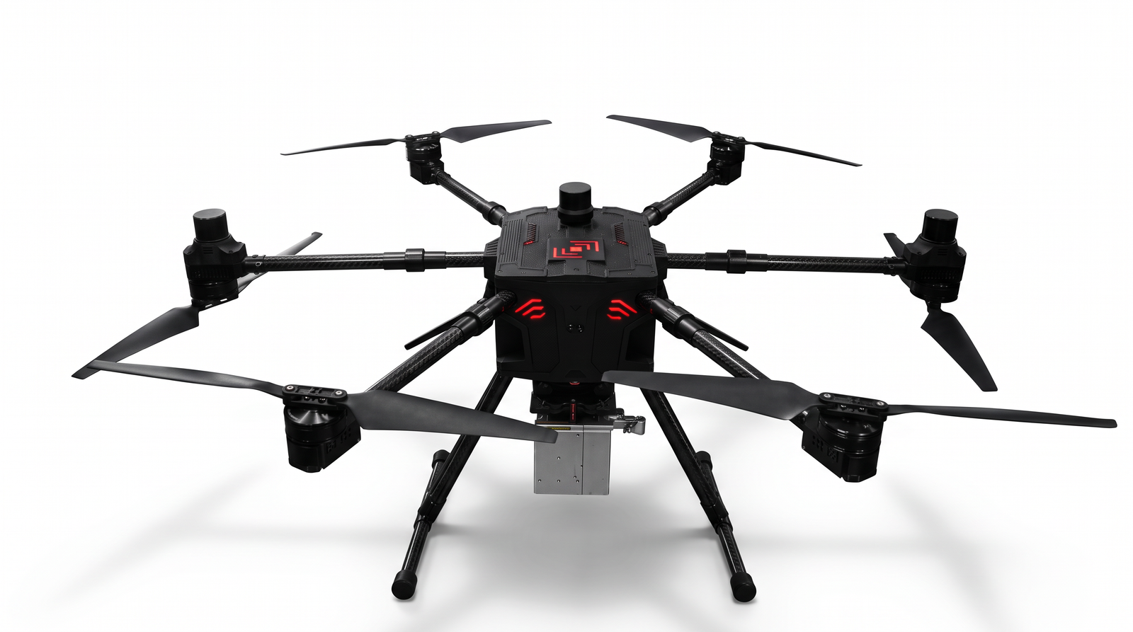
Latrics describes the LiCopter P720 as an indigenous, DGCA type-certified LiDAR drone with an indigenous LiDAR integrated with IMU and GPS. It has a foldable design, detect-and-avoid, operation from -20°C to 55°C, and a quick-release payload bay for LiDAR, RGB and multispectral sensors. Its payload list also includes a 61MP camera and an oblique camera.
Best for: mining, highway and energy teams that want a drone built around its own LiDAR.
Versus the Sigma100: it is strong on survey, but its published payload list has no zoom, thermal or observation options, and the endurance it quotes with payload is shorter. It does cover colder conditions better.
5. AMX Model M: rugged LiDAR drone for tough conditions
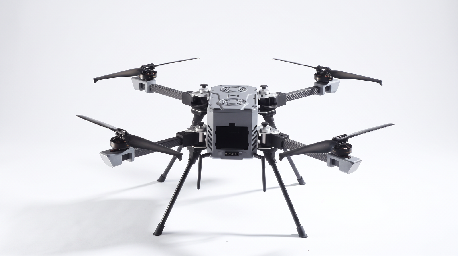
AMX describes the Model M as India’s first DGCA Type Certified multi-rotor LiDAR drone. It is RTK-ready and IP55-rated, with a hot-swappable payload system for LiDAR, RGB and thermal cameras, a foldable airframe and hot-swappable batteries.
Best for: surveyors who work in dust, humidity or rain and want LiDAR plus thermal inspection in a compact package.
Versus the Sigma100: it covers survey and thermal inspection but not oblique, multispectral or zoom payloads, and AMX does not publish endurance or payload figures.
LiDAR drones compared: side by side
| Indrones Sigma100 | ideaForge Q6 V2 GEO | Trinity F90+ | Latrics LiCopter P720 | AMX Model M | |
| Airframe | Multirotor | Multirotor | Fixed-wing VTOL | Multirotor | Multirotor |
| Published endurance | Up to 63 min | Up to 45+ min | Up to 60 min with LiDAR | ~40–45 min with payload | Not published |
| LiDAR | Certified payload | Yes | Yes | Yes | Yes |
| Survey RGB | 24 MP, certified | Photogrammetry | RGB | 61 MP | RGB |
| Oblique / 3D | Penta, certified | Yes | Yes | Yes | Not listed |
| Zoom surveillance | 30x, certified | Day/night | Not listed | Not listed | Not listed |
| Thermal | Compatible | Day/night | Not listed | Not listed | Yes |
| Multispectral | Compatible | Not listed | Yes | Yes | Not listed |
| Custom payload | Up to 1.5 kg | Not listed | Not listed | Not listed | Not listed |
Figures come from each manufacturer’s published material and are not like-for-like tests. “Not listed” means not found in the sources reviewed.
LiDAR drones vs photogrammetry drones
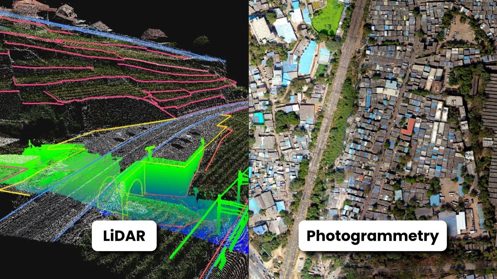
LiDAR and photogrammetry drones solve different problems:
- LiDAR drones measure distance directly with laser pulses. They excel under vegetation, in low-texture areas, and for precise terrain models.
- Photogrammetry drones build 3D models from overlapping photos. They deliver rich visual texture and colour at lower sensor cost.
Many projects need both, which is why a multi-payload LiDAR drone such as the Sigma100, with LiDAR, a 24 MP survey camera and a penta oblique camera, can replace two separate aircraft.
Which LiDAR drone should you choose?
- Choose the Sigma100 for one certified aircraft that runs LiDAR, survey mapping, 3D oblique and zoom inspection, with room to add thermal or multispectral.
- Choose the Q6 V2 GEO if you are a large enterprise or agency that wants a bundled software stack.
- Choose the Trinity F90+ if your work is almost entirely very large area mapping.
- Choose the LiCopter P720 if your work is almost entirely LiDAR and you want an indigenous LiDAR-first system.
- Choose the AMX Model M if rough field conditions matter most and your jobs are survey plus thermal inspection.
The bottom line
All five LiDAR drones here are credible, certified options, and each excels at something. The Sigma100 stands apart because it refuses to be one-dimensional: LiDAR, survey RGB, penta-oblique 3D and 30x zoom sit inside one certificate, with the longest published endurance in this group and headroom for thermal and multispectral. For teams that want their LiDAR drone to keep earning between scanning jobs, that breadth is the real advantage.
Talk to the UAVGarage team about your terrain, accuracy targets, and payload mix, and we will help you configure the right Sigma100 setup.