Your bag is empty
Don't miss out on great deals! Start shopping or Sign in to view products added.
Shop What's New Sign in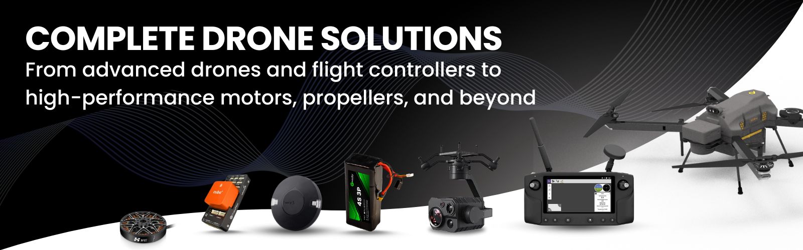


305MP resolution with 40mm/56mm dual-lens option
Compact design with 35.9 x 23.9mm sensor
4K and 1080P video output at 30fps (5 channels)
Exposure feedback with 10μs precision
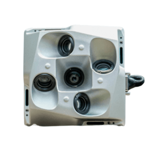
510MP resolution with dual 50mm/75mm lens
Large 43.8 x 32.8mm sensor for wide field coverage
Real-time 4K & 1080P video at 30fps (5 channels)
10μs exposure feedback accuracy
Compact and lightweight: 150g
Post-processed accuracy: 2–5 cm
Roll & pitch precision: 0.025°, heading: 0.08°
Rugged build for extreme temperatures and altitudes
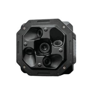
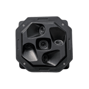
225MP resolution for detailed aerial imaging
Dual focal length: 50 mm / 75 mm
10μs exposure feedback accuracy
Real-time 4K & 1080P video
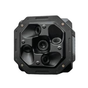
305MP high-resolution aerial imaging
Dual 50 mm / 75 mm lens system
10μs exposure feedback for sharp timing
Supports 4K & 1080P video on 5 channels

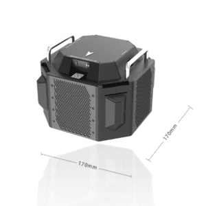
510MP ultra-high-resolution sensor
Dual 50 mm / 75 mm lens with adjustable FOV
10μs exposure feedback for pinpoint accuracy
Supports 4K & 1080P video across 5 channels


Built for high-accuracy GNSS survey and mapping
Simple, intuitive interface—perfect for field teams
Compatible with Android tablets and EFIX data controllers
Supports topographic, stakeout, and COGO workflows
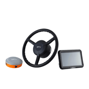
2.5 cm pass-to-pass accuracy (0.2–25 km/h speed range)
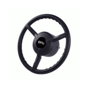
Supports front/rear-wheel, articulated, and tracked vehicles
Compatible with multiple line guidance modes
One-click calibration and one-button start
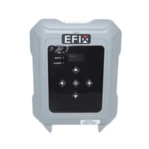

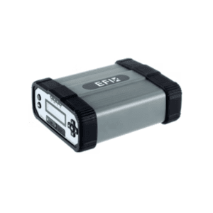
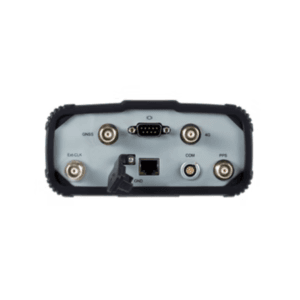
RTK correction range up to 30+ km
Adjustable power output up to 28 W
LCD display with LED indicators and buttons
Rugged IP67-rated waterproof and dustproof build
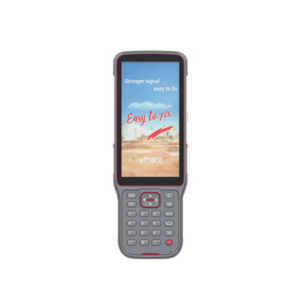
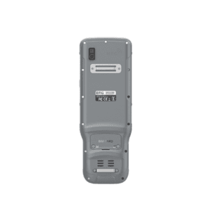
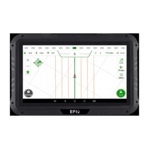
5.5" HD+ touchscreen, sunlight-readable
Rugged IP67 build, 2m drop resistance
8000 mAh battery for 14-hour use
Android 10 with eField app pre-installed

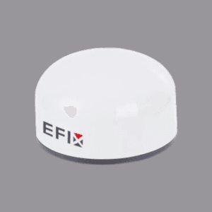
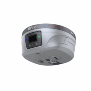
Supports GPS, GLONASS, Galileo, BeiDou & more
High-gain LNA with superior multipath rejection
Millimeter-level precision and phase stability
Ideal for surveying, mapping, and engineering tasks
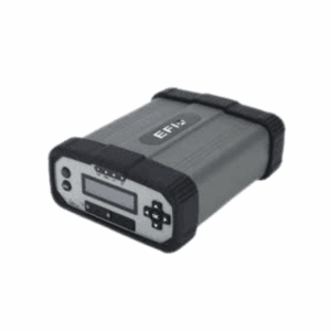
Tracks GPS, GLONASS, Galileo, BeiDou & SBAS signals
Delivers high-quality GNSS raw data
Ideal for use as RTK network base station
Ensures reliable and precise positioning across applications
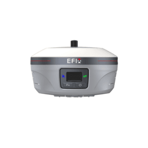
1608-channel GNSS with full constellation support
Integrated 4G LTE, Wi-Fi, Bluetooth 5.0 & UHF (up to 25 km)
Real-time accuracy: 8mm + 1 ppm; PPK: 3mm + 1 ppm
4D IMU with 60° tilt compensation & 200Hz rate