Your bag is empty
Don't miss out on great deals! Start shopping or Sign in to view products added.
Shop What's New Sign in


Price range: ₹1,120,499.00 through ₹3,064,369.00 excl. GST
Available in stock
₹1,176,523.96 Incl. GST
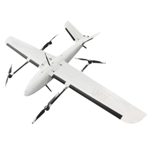
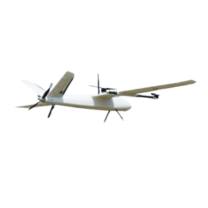
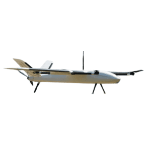
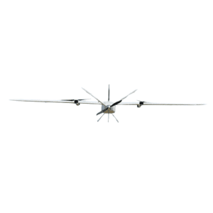
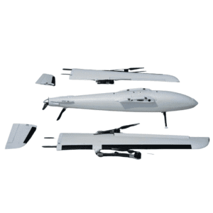
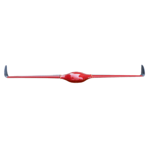
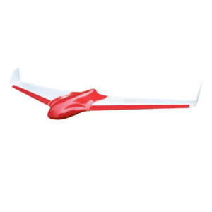
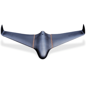
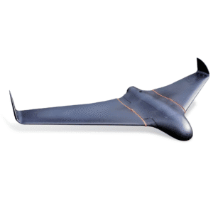
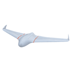
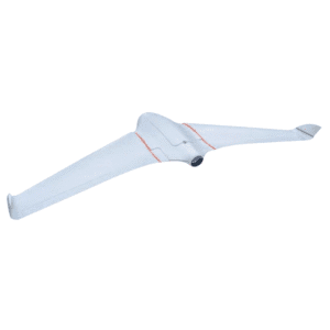
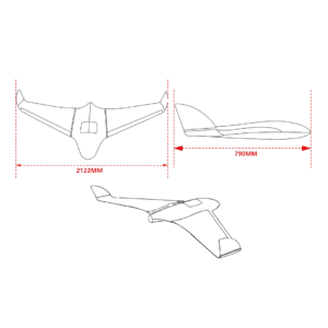
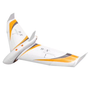
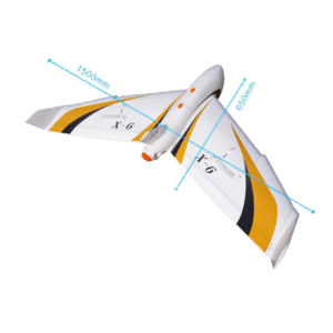
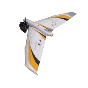
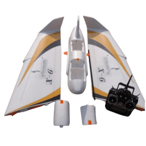
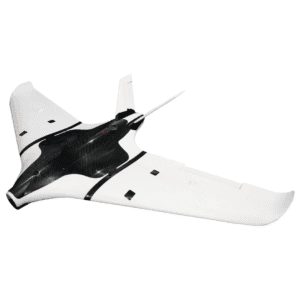
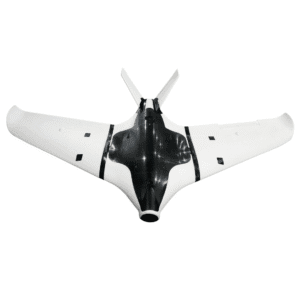
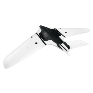
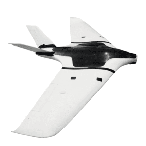
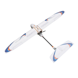
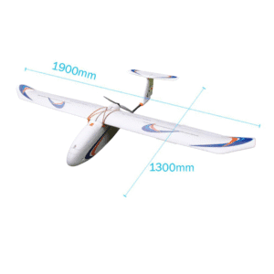
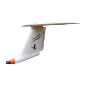
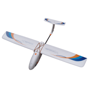
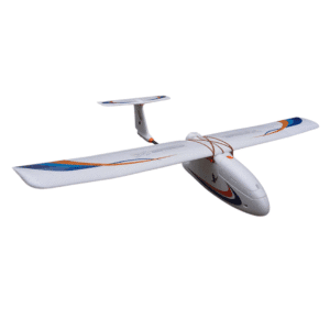
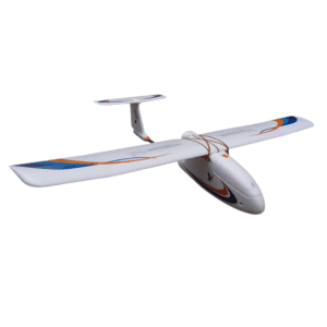
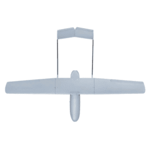
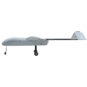
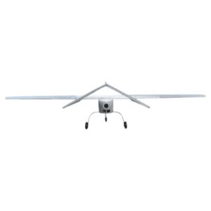
The Skyeye UAV SS600 Fixed-Wing UAV Drone is a large-scale aerial platform built for professional mapping, surveillance, and industrial missions. Featuring a massive 6000mm wingspan and an H-tail configuration, this aircraft combines aerodynamic efficiency with exceptional payload capacity and endurance. Constructed from premium carbon fiber, the SS600 ensures durability, reduced weight, and superior flight performance, even under challenging conditions.
Engineered for reliability and long-distance performance, the Skyeye SS600 achieves up to 7 hours of flight time. Its 27L fuel capacity supports extensive aerial coverage, making it ideal for missions like environmental surveys, border monitoring, and large-scale mapping. The aircraft’s aerodynamic H-tail design provides greater stability and smoother control, ensuring precision flight over long durations.
With a cruising speed of 35m/s and a maximum speed of 40m/s, the SS600 maintains consistent performance while maximizing operational efficiency.
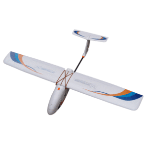
The carbon fiber airframe not only enhances strength but also reduces vibration, providing smooth flight for sensitive payloads. The SS600 can carry a payload of up to 30kg and handle a maximum takeoff weight of 110kg, accommodating high-end sensors, LiDAR systems, and advanced camera equipment for professional-grade data collection.
The large internal payload bay (920mm × 340mm × 350mm) offers flexibility for integrating multiple systems and specialized mission equipment.
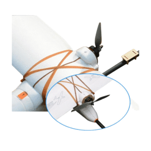
Equipped with a tail-thruster engine, the Skyeye SS600 delivers consistent propulsion with optimized fuel efficiency. The PNP (Plug-and-Play) version comes with professional-grade servos, a robust propeller, and a precision pitot tube for accurate airspeed measurement. Every component is designed for reliability and ease of maintenance during field operations.
The Skyeye SS600 is ideal for a variety of industrial and research uses, offering both stability and customization for professional mission profiles:
Aerial Mapping & GIS Surveys – Capture high-precision topographic data over vast terrains.
Environmental & Forestry Monitoring – Perform long-range observation and documentation.
Industrial & Infrastructure Inspection – Inspect power lines, pipelines, and large facilities.
Research & Development – A robust platform for testing UAV components and payload systems.
| Type | KIT, Power System, PNP, PRO(Accessories installed) |
|---|
| Parameter | Specification |
|---|---|
| Material | Carbon Fiber |
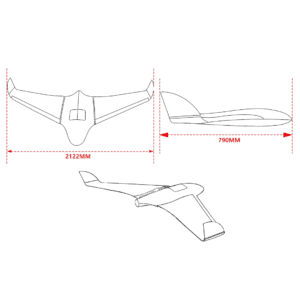
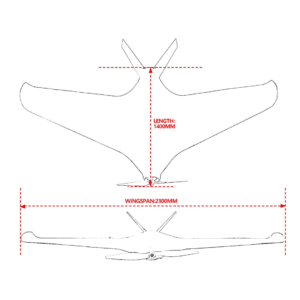
| Wingspan | 6000mm |
| Length | 3500mm |
| Wing Area | 312dm² |
| Empty Weight | 33.6kg |
| Payload Capacity | 30kg |
| Max Takeoff Weight | 110kg |
| Fuel Tank Capacity | 27L |
| Payload Bay Size | 920 × 340 × 350 mm |
| Cruising Speed | 35m/s |
| Maximum Speed | 40m/s |
| Stall Speed | 24m/s |
| Maximum Flight Time | 7 Hours |
| Configuration | H-Tail |
| Servos | 10 |
| Pitot Tube | Included |
6000mm wingspan professional-grade fixed-wing UAV.
Lightweight carbon fiber airframe with H-tail design.
30kg payload capacity and 110kg takeoff weight.
7-hour endurance and 27L fuel tank for long missions.
Ideal for mapping, monitoring, and industrial aerial surveys.