Your bag is empty
Don't miss out on great deals! Start shopping or Sign in to view products added.
Shop What's New Sign in
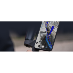
Pix4D Autotags are machine-readable, coded visual markers designed to revolutionize the way ground control points (GCPs) are handled in mobile mapping. Specifically optimized for the PIX4Dcatch app, these targets eliminate the tedious task of manually marking points in dozens of images. By placing these physical tags on-site before your walk-through, the software automatically recognizes, identifies, and centers each point with pixel-perfect precision. This is a game-changer for high-stakes environments like emergency response or active construction sites where speed and accuracy must coexist.
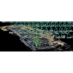
The true power of Autotags lies in their Real-Time Detection. As you move across a site with PIX4Dcatch, the app’s computer vision engine “locks” onto the tags instantly, providing visual confirmation that the point has been captured. This integration significantly enhances Augmented Reality (AR) stability, ensuring that any CAD or design overlays remain perfectly pinned to the real world. Furthermore, using Autotags drastically reduces processing time in PIX4Dmatic or PIX4Dcloud, as the algorithms no longer need to “search” for targets; they simply read the unique ID encoded in the tag.
Designed for high-contrast visibility, Autotags are typically printed on non-reflective materials to prevent glare during capture. They are distributed across the survey area much like traditional GCPs—ideally at the corners and center—to provide a stable geometric framework for the 3D model. While the system can function with as few as three tags for basic orientation, using a set of 5 to 10 targets is recommended to achieve the centimeter-level absolute accuracy required for professional surveying and engineering reports.
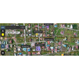
For Public Safety and Forensics, Autotags allow investigators to secure a scene and place markers that ensure the resulting 3D model is court-ready and perfectly scaled without manual intervention. In Utility Mapping, they serve as permanent reference points for “digital trenching,” allowing teams to revisit a site and see exactly where pipes were laid beneath the surface. For Construction Teams, they simplify the workflow of comparing daily progress against BIM models, as the Autotags ensure the mobile scan aligns perfectly with the project’s global coordinate system every single time.