Your bag is empty
Don't miss out on great deals! Start shopping or Sign in to view products added.
Shop What's New Sign in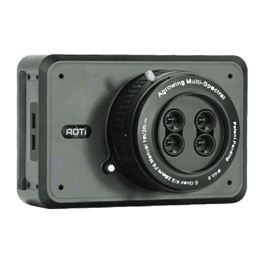
Available in stock
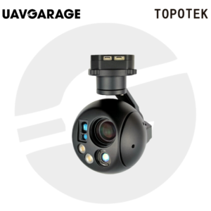
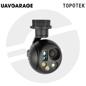
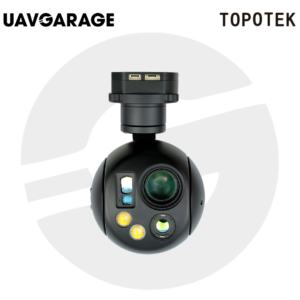
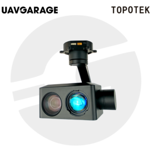
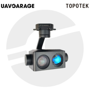
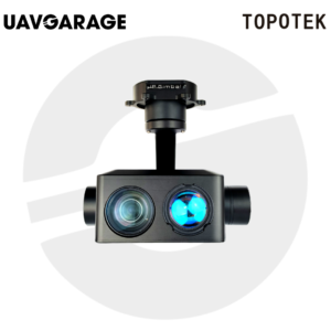
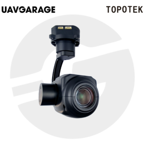
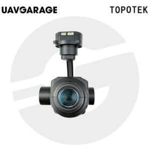
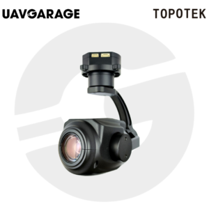
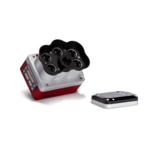
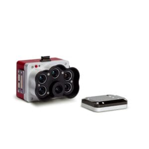
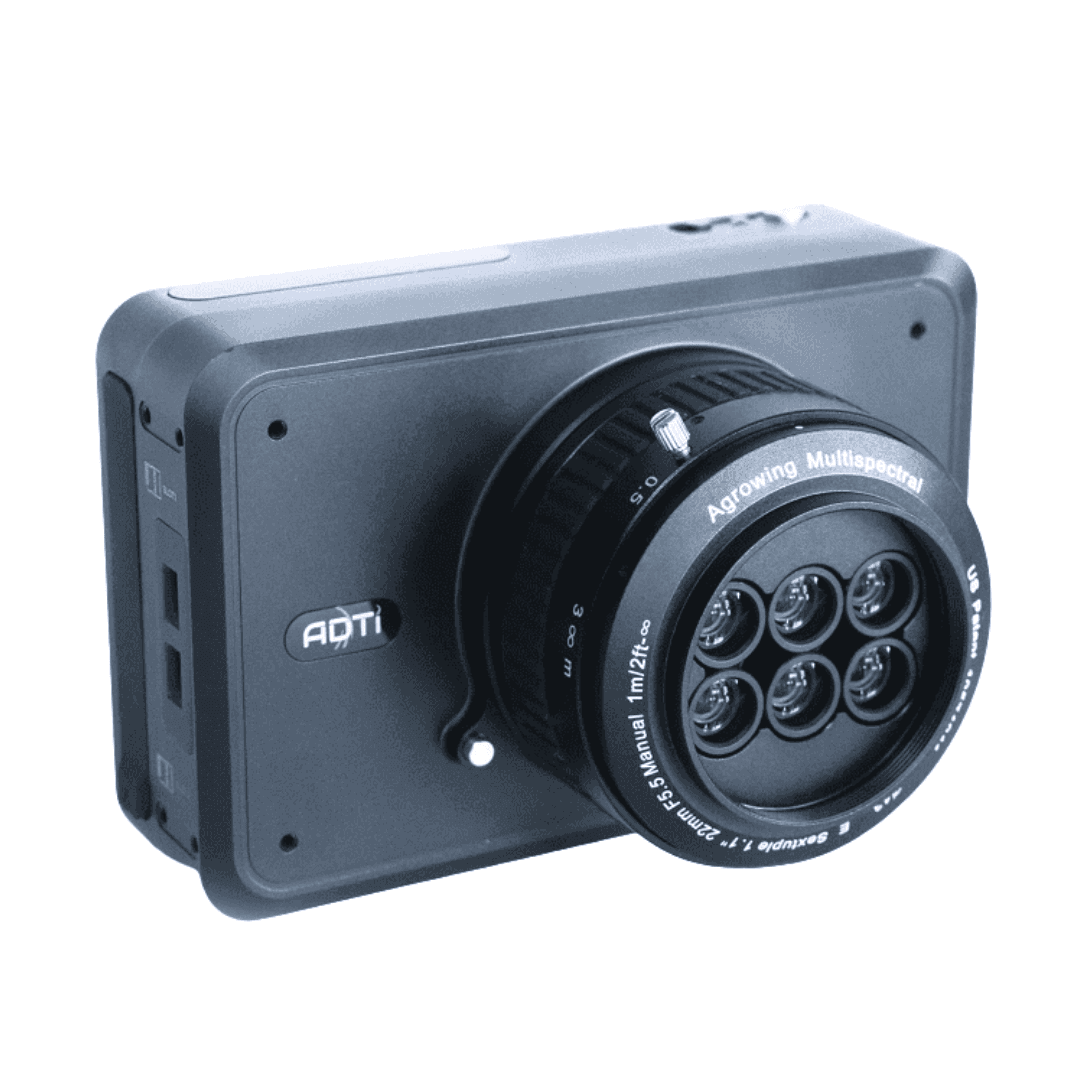
The ADTi 61Pro Surveyor is a professional-grade aerial imaging system. This camera offers unmatched flexibility with both Quad and Sextuple multispectral configurations. It is specifically designed for Full-Frame E-Mount cameras. The camera is dual-purpose, easily converting to a standard RGB mapping camera. Simply use a clip-in IR-cut filter for this conversion. Furthermore, its lightweight design is engineered for superior aerial integration. This makes the ADTi 61Pro an essential tool for high-accuracy surveying.
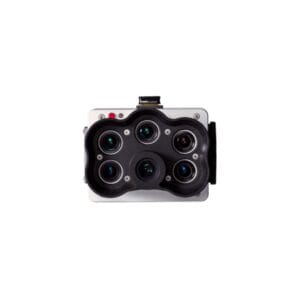
The system provides incredible image resolution across its narrow bands. The Quad configuration delivers 12 Megapixel per band. Conversely, the Sextuple configuration provides 7.5 Megapixel per band. You can choose between 10 or 14 customized narrow bands. This versatility ensures optimal data collection for any project. The system uses a single lens mount and maintains a fixed F-number of 6.0. This ensures consistent image quality across all spectral channels.
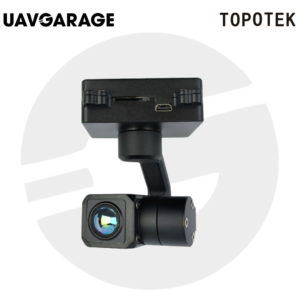
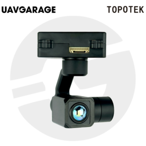
Designed for professional drones, the ADTi 61Pro offers easy gimbal integration. The complete camera and lens weigh just 450 grams. Crucially, the camera body integrates effortlessly with the DJI X-port gimbal. The total weight with the DJI X-port gimbal and lens is only 788 grams. Integration is also available for the Gremsy gimbal, weighing 915 grams. This compatibility streamlines deployment on popular commercial platforms. The compact dimensions (120mm x 80mm x 42mm) also aid drone mounting.
The camera features a Quad-lens single mount configuration. The effective focal length is 25mm. The field of view is wide, with 45.90 degrees diagonal. It boasts very low TV distortion, less than 1%. The 10 or 14 narrow bands are 30nm wide. These Chroma bands cover 405, 430, 450, 550, 560, 570, 650, 685, 710, and 850nm. The lens weight is 182 grams, contributing to a total sensor weight of 424 grams. Manual focus ranges from 2m to infinity.
The ADTi 61Pro is built for demanding aerial survey tasks. The high spatial and spectral resolution is ideal for detailed vegetation mapping and infrastructure inspection. Its dual-purpose nature allows rapid switching between multispectral analysis and standard RGB mapping. This flexibility maximizes mission efficiency and data utility.