Your bag is empty
Don't miss out on great deals! Start shopping or Sign in to view products added.
Shop What's New Sign in
Available in stock
Agisoft Metashape
Agisoft Metashape is a standalone photogrammetry software designed to transform digital imagery into high-quality spatial data. It enables users to generate dense point clouds, 3D models, orthomosaics, digital surface models (DSMs), and digital terrain models (DTMs). The software supports images from multiple sources including RGB, multispectral, thermal, satellite, and even video and LiDAR data, making it ideal for a wide range of applications in surveying, mapping, agriculture, archaeology, forensics, construction, and more.
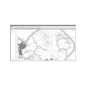
The workflow begins with image alignment and aerial triangulation. The software automatically detects common features in images to reconstruct precise camera positions. Following alignment, users can generate detailed point clouds and mesh models. These can be textured and georeferenced with optional ground control points to ensure top-tier accuracy. For even better performance, Metashape supports multi-camera systems and can process oblique, nadir, and panoramic images with ease.
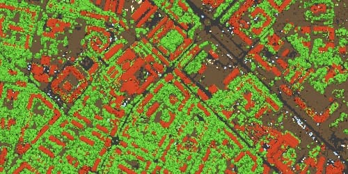
With its advanced tools, Metashape makes handling complex projects straightforward. Users benefit from automatic classification of dense clouds, mesh editing, seamline adjustment in orthomosaics, and volume calculations. For agricultural use, the software also computes vegetation indices like NDVI, NDRE, and GNDVI from multispectral imagery.
Another strong feature of Metashape is its automation capability. Batch processing allows users to configure multiple steps into a single job. Additionally, Python and Java scripting support make it easy to integrate Metashape into custom workflows. Users can also run the software headlessly for command-line processing on remote systems.
Measurement and analysis tools are built in. Users can measure distances, areas, and volumes, generate contour lines, and perform power line detection. Orthomosaics can be edited directly for improved visual clarity. The software even offers stereoscopic viewing options for precise 3D editing.
Agisoft Metashape takes full advantage of GPU acceleration and supports parallel processing for increased efficiency. Whether working on small projects or enterprise-scale photogrammetry, the software delivers consistent and accurate results. Additionally, users have access to network processing and cloud-based tools to optimize performance.
Professionals across industries choose Metashape for its combination of precision, flexibility, and reliability. Its intuitive interface is friendly for beginners, yet powerful enough for demanding expert workflows. With frequent updates and broad compatibility, Metashape remains a trusted tool for 3D data generation and analysis.
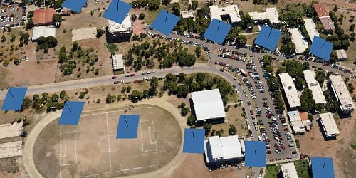
Processing of various types of imagery: aerial (nadir, oblique), close-range, satellite.
Auto calibration: frame (incl. fisheye), spherical & cylindrical cameras.
Multi-camera projects support.
Scanned images with fiducial marks support.
Elaborate model editing for accurate results.
Automatic multi-class points classification to customize further reconstruction.
Import/export to benefit from classical point data processing workflow.
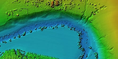
Digital surface and/or digital terrain model — depending on the project.
Georeferencing based on EXIF meta data/flight log, GCPs data.
EPSG registry coordinate systems support: WGS84, UTM, etc.
Configurable vertical datums based on the geoid undulation grids.
DEM editing: breaklines drawing, fill tools.
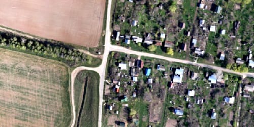
Georeferenced orthomosaic: most-GIS-compatible GeoTIFF format; KML files to be located on Google Earth.
Export in blocks for huge projects.
Color correction for homogeneous texture.
Inbuilt ghosting filter to combat artifacts due to moving objects.
Custom planar and cylindrical projection options for close range projects.