Your bag is empty
Don't miss out on great deals! Start shopping or Sign in to view products added.
Shop What's New Sign in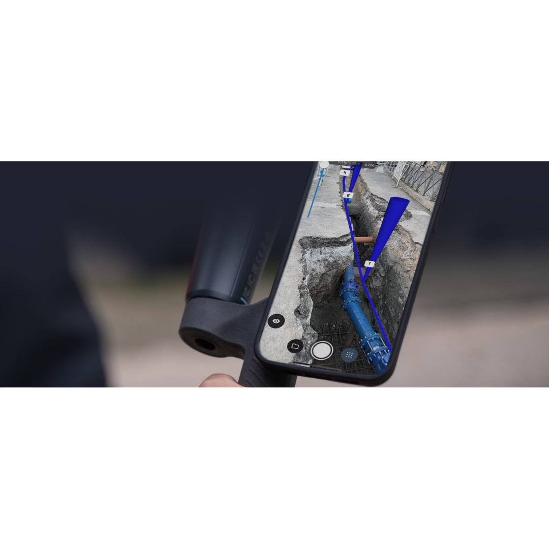
Price range: ₹144,022.20 through ₹550,726.40 excl. GST
Available in stock
M.R.P.: ₹169,946.20 Incl. GST
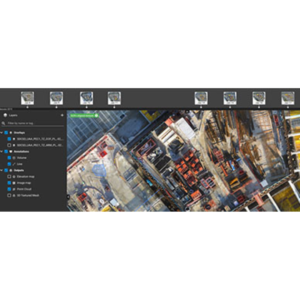
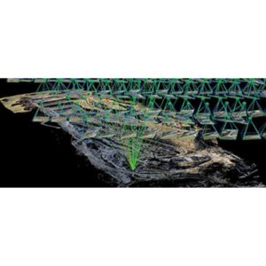
PIX4Dcatch transforms your smartphone or tablet into a professional-grade surveying tool. By fusing LiDAR technology, photogrammetry, and RTK positioning, it allows users to capture high-accuracy 3D models of the world around them by simply walking. It is the perfect bridge between quick mobile capture and professional surveying, designed specifically for professionals in AEC (Architecture, Engineering, and Construction), forensics, and utility management who need survey-grade results without bulky equipment.
The app’s standout capability is its Augmented Reality (AR) suite. Users can overlay digital design files (DXF or IFC) directly onto the physical site to verify construction progress in real-time. For subsurface work, PIX4Dcatch allows you to “see” buried utilities through the screen after trenches have been closed, using previous scans. During data acquisition, the Live 3D Mesh provides instant feedback, showing exactly which areas have been covered and ensuring no data gaps exist before you leave the field.
PIX4Dcatch is optimized for modern hardware, utilizing the LiDAR sensors found in the latest iPhones and iPads to enhance depth perception and scale accuracy. It supports a wide variety of external RTK rovers (like the Emlid Reach RX or viDoc) to reach centimeter-level precision. Data captured in the app can be uploaded instantly to PIX4Dcloud for automated processing or exported to PIX4Dmatic for advanced desktop photogrammetry workflows.
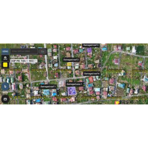
In utility mapping, it is used for “digital trenching,” providing a 3D record of pipes and cables before they are covered. Construction managers use the AR overlay features to check “as-built” reality against BIM models to catch errors early. For forensics, investigators can rapidly document crime or accident scenes with high detail, preserving a digital twin that can be revisited months later. It is also an excellent tool for stockpile volume measurements in tight spaces where drones cannot fly.
| Type | PIX4Dcatch Pro, PIX4Dcatch Pro + PIX4Dcloud Pro |
|---|---|
| Plan | Monthly, Yearly, 3 Years |