Your bag is empty
Don't miss out on great deals! Start shopping or Sign in to view products added.
Shop What's New Sign in
Available in stock
M.R.P.: ₹212,699.96 Incl. GST
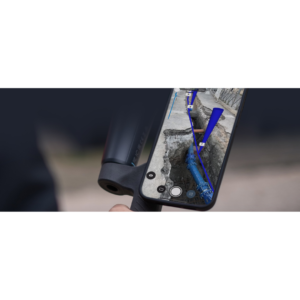
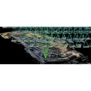
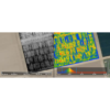
PIX4Dfield is a high-efficiency mapping software specifically designed for aerial crop analysis and digital farming. By combining drone imagery with satellite data, it provides a hybrid solution that helps farmers and agronomists make faster, data-driven decisions. Unlike traditional photogrammetry, PIX4Dfields is optimized for speed, allowing you to process thousands of images and generate accurate maps in minutes, often right at the edge of the field without an internet connection.
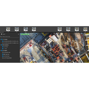
The software supports a wide range of cameras, from standard RGB to advanced multispectral sensors like the MicaSense RedEdge or DJI Mavic 3 Multispectral. Its “Magic Tool” uses AI to automatically detect anomalies, such as weed nests or crop damage, allowing for targeted intervention. You can create custom vegetation indices or use predefined ones like NDVI and NDRE to visualize plant stress levels. Furthermore, the Targeted Operations tool allows you to generate prescription maps with up to seven different rate zones, which can be exported directly to tractors and spray drones.
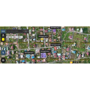
From trial plot management to large-scale commercial farming, PIX4Dfields is the ultimate toolkit for modern agriculture. It integrates seamlessly with the John Deere Operations Center, allowing for a smooth flow of data from the air to the machinery. Agronomists use it for digital scouting to identify irrigation variability and erosion-prone areas. By reducing the over-use of chemicals through spot-spraying maps, it not only saves money but also significantly lowers the environmental footprint of farming operations.
| Plan | Monthly, Yearly, 3 Years |
|---|