Your bag is empty
Don't miss out on great deals! Start shopping or Sign in to view products added.
Shop What's New Sign in
Available in stock
M.R.P.: ₹426,468.76 Incl. GST
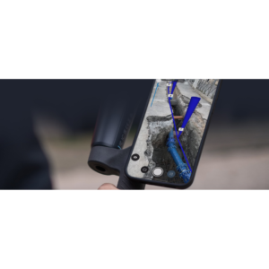
PIX4Dmapper is the industry-standard photogrammetry software designed for professionals who need absolute precision. It transforms standard RGB, thermal, or multispectral images into survey-grade, georeferenced results. Unlike entry-level tools, PIX4Dmapper provides a rigorous “rayCloud” environment where you can interactively verify the accuracy of every 3D point against the original images. It is the core tool for “classic” drone mapping, offering complete control over the processing workflow to ensure that your digital twins are as accurate as the real world.
The software features an advanced automatic point cloud densification engine that creates highly detailed 3D models. One of its standout capabilities is Machine Learning-based Point Cloud Classification, which automatically separates your data into categories like ground, buildings, and vegetation. This allows for the instant generation of Digital Terrain Models (DTM) by stripping away trees and structures. Additionally, its robust radiometric calibration tools make it an essential asset for multispectral analysis, ensuring that crop health indices are comparable over time and across different lighting conditions.
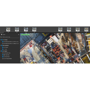
PIX4Dmapper is built to handle complex geometry and high-resolution sensors. It supports a wide array of outputs, including .LAS/.LAZ point clouds, GeoTIFF orthomosaics, and 3D textured meshes in formats like .OBJ and .FBX. The software is optimized for local processing, meaning your data stays secure on your machine without needing a constant internet connection. For projects requiring the highest possible accuracy, it integrates seamlessly with Ground Control Points (GCPs) and MTPs to tie your maps to global coordinates with sub-centimeter precision.
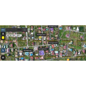
In the surveying and construction industries, PIX4Dmapper is used for topographic mapping, volume calculations of stockpiles, and cut-and-fill analysis. Mining and quarrying operations rely on it for frequent site monitoring and safety inspections. In agriculture, it processes multispectral data to identify irrigation issues and plant stress before they are visible to the naked eye. Furthermore, its ability to generate high-resolution 3D models makes it a vital tool for telecom and utility inspections, allowing engineers to measure vertical assets like cell towers and bridges from the safety of their desks.
| Plan | Monthly, Yearly |
|---|