Your bag is empty
Don't miss out on great deals! Start shopping or Sign in to view products added.
Shop What's New Sign in
Available in stock
M.R.P.: ₹117,572.84 Incl. GST
The PIX4Dmatic Educational licenses brings next-generation photogrammetry and LiDAR processing into the classroom and research lab. Designed specifically for academic institutions, this license provides students and professors with the same powerful tools used by industry professionals for large-scale and corridor mapping. It bridges the gap between theoretical geospatial science and practical field application, allowing users to process thousands of images and LiDAR datasets without the need to split or merge projects. Whether for civil engineering, environmental science, or archaeology, PIX4Dmatic provides a robust foundation for high-accuracy digital reconstruction.
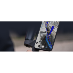
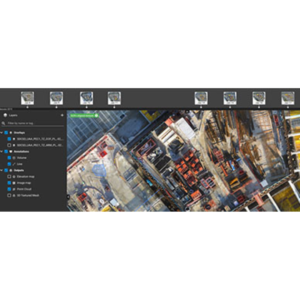
A standout feature of PIX4Dmatic is its ability to fuse LiDAR and photogrammetry data within a single workspace. This is particularly effective when processing data from PIX4Dcatch, combining the visual detail of RGB imagery with the structural precision of depth sensors. The software includes automated terrain classification, which uses machine learning to separate ground points from vegetation and man-made structures—an essential step for creating accurate Digital Terrain Models (DTMs). Educational users also benefit from unlimited desktop processing, ensuring that research is never capped by credit systems or image counts.
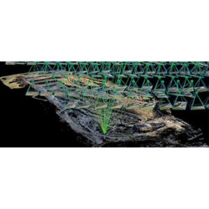
Built for the future of mapping, PIX4Dmatic is optimized for hardware that leverages both multi-core CPUs and GPU acceleration, resulting in processing speeds up to 50% faster than traditional photogrammetry software. It supports a wide range of vertical coordinate systems and geoids, ensuring that student projects meet professional survey standards. The license structure is flexible, offering Student (short-term), Professor (single-seat yearly), and Classroom (25-seat) options, all of which include full commercial features, dedicated support, and access to the latest software upgrades.
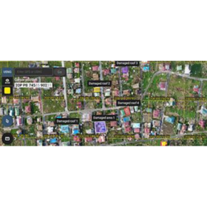
In academic research, PIX4Dmatic is used to monitor coastal erosion, track urban development, and map vast archaeological sites with survey-grade precision. University professors utilize the classroom licenses to teach the fundamentals of 3D modeling and geospatial data analysis, providing students with hands-on experience in generating CAD-ready deliverables. It is also a vital tool for environmental studies, where the automated DTM generation allows researchers to analyze topography beneath dense forest canopies or evaluate watershed health after natural disasters.
Dataset Capacity (Images)5,000+ images per project
Processing Speed (Efficiency)Up to 50% faster than legacy tools
Accuracy Level (GSD)1-2 pixels (XY), 1-3 pixels (Z)
License VariantsStudent, Professor, & Classroom (25-seat)
RAM Requirement (Large Projects)128GB (Recommended for 10k+ images)