Your bag is empty
Don't miss out on great deals! Start shopping or Sign in to view products added.
Shop What's New Sign in
Available in stock
M.R.P.: ₹26,721.10 Incl. GST
PIX4Dreact Educational Licenses is a 2D fast-mapping software specifically designed for situational awareness in time-critical environments. This academic license provides students and training centers with the tools used by emergency responders and humanitarian aid organizations to turn drone imagery into measurable maps in minutes. Unlike traditional photogrammetry software that requires hours of processing, PIX4Dreact focuses on speed and field-readiness, making it an ideal teaching tool for disaster management, public safety, and rapid response curriculum.
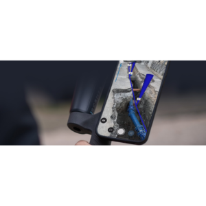
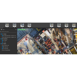
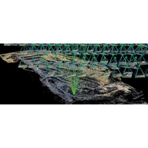
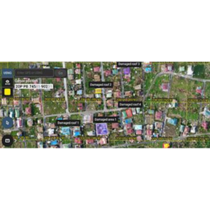
The software is celebrated for its Fast-Stitching Engine, which operates entirely offline, allowing maps to be processed on a standard laptop directly at a “scene” without internet. It includes a robust Comparison Tool that enables users to view “before and after” maps side-by-side using a split-screen slider—perfect for analyzing the impact of natural disasters or urban changes. Students can utilize the Marker and Measurement tools to pinpoint hazards or logistical points, then generate a lightweight PDF Report for instant distribution to mock command centers.
PIX4Dreact is built to be lightweight and robust, optimized for mid-range hardware rather than high-end workstations. It supports standard RGB imagery from the most popular drone models and provides specialized outputs like Digital Surface Models (DSM) to help visualize terrain elevation. For academic institutions, the license structure includes Classroom options (up to 25 seats) and Professor licenses, both of which come with access to educational materials and significant discounts on official Pix4D training and certification programs.
In Emergency Management programs, PIX4Dreact is used to simulate search-and-rescue operations where students must map a “disaster zone” and identify safe routes for personnel. Law Enforcement and Public Safety students use it for tactical pre-planning and scene documentation. In Humanitarian Aid studies, the software helps researchers map displaced person camps or assess infrastructure damage after extreme weather events, providing a clear aerial overview when existing maps are outdated or unavailable.