Your bag is empty
Don't miss out on great deals! Start shopping or Sign in to view products added.
Shop What's New Sign in
Available in stock
M.R.P.: ₹105,815.56 Incl. GST
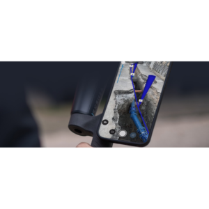
PIX4Dreact is a high-speed 2D mapping software specifically engineered for public safety, emergency management, and humanitarian aid. When every second counts, this desktop application turns drone imagery into accurate maps in minutes, not hours. Designed to work entirely offline, it ensures that teams on the ground have reliable situational awareness even in remote areas without internet or cloud access. It simplifies the complex photogrammetry process into an intuitive workflow, allowing responders to focus on the mission rather than the technology.
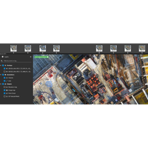
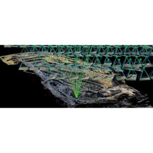
The software utilizes a specialized fast-stitching engine to create high-resolution orthomosaics from nadir (straight-down) drone images. It includes a dedicated Comparison Tool with split and swipe views to monitor evolving situations or compare “before and after” disaster data. To assist with tactical planning, the Marker and Measurement Tools allow users to pinpoint points of interest and calculate distances or areas on the fly. Furthermore, the inclusion of the US National Grid overlay ensures that data is universally understood by all federal and local agencies during joint operations.
PIX4Dreact is designed to be lightweight enough to run on mid-range laptops directly in the field. It primarily processes standard RGB images in JPEG format and can import pre-processed GeoTIFFs from other Pix4D software. The output ecosystem is highly versatile, supporting exports such as GeoTIFF for GIS platforms, GeoJSON/KML for markers, and comprehensive PDF Reports that are compact enough to be shared via email or messaging apps even with limited bandwidth. It supports a wide range of popular drones, ensuring compatibility with your existing fleet.
This software is an essential asset for Search and Rescue (SAR), where it helps teams quickly map search areas to identify missing persons or hazards. During natural disasters like flooding or wildfires, PIX4Dreact provides an immediate aerial overview to guide resource allocation and evacuation routes. Public safety officers use it for tactical planning and event security to identify crowd bottlenecks or secure perimeters. It is also a powerful tool for documenting crime scenes and traffic accidents, providing a permanent and measurable 2D record of the site before it is cleared.
| Plan | Monthly, Yearly, 3 Yearly |
|---|