 PIX4Dcloud Educational Licenses ₹81,522.00
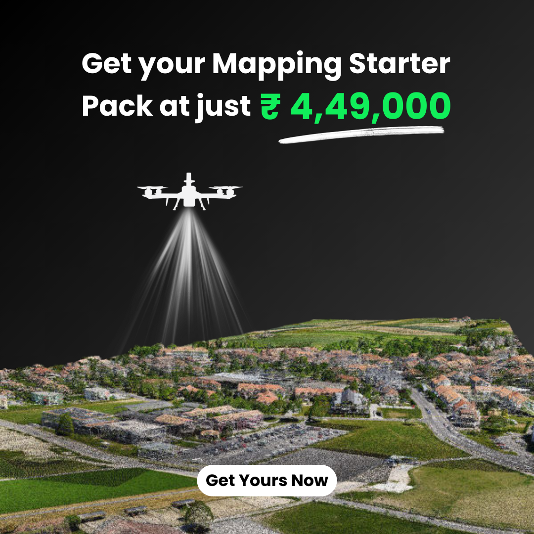
PIX4Dmatic: Photogrammetry Software for Professional Mapping
Price range: ₹207,428.20 through ₹451,994.20 excl. GST
Available in stock
M.R.P.: ₹244,765.28 Incl. GST
Check delivery availability:
Description
PIX4Dmatic
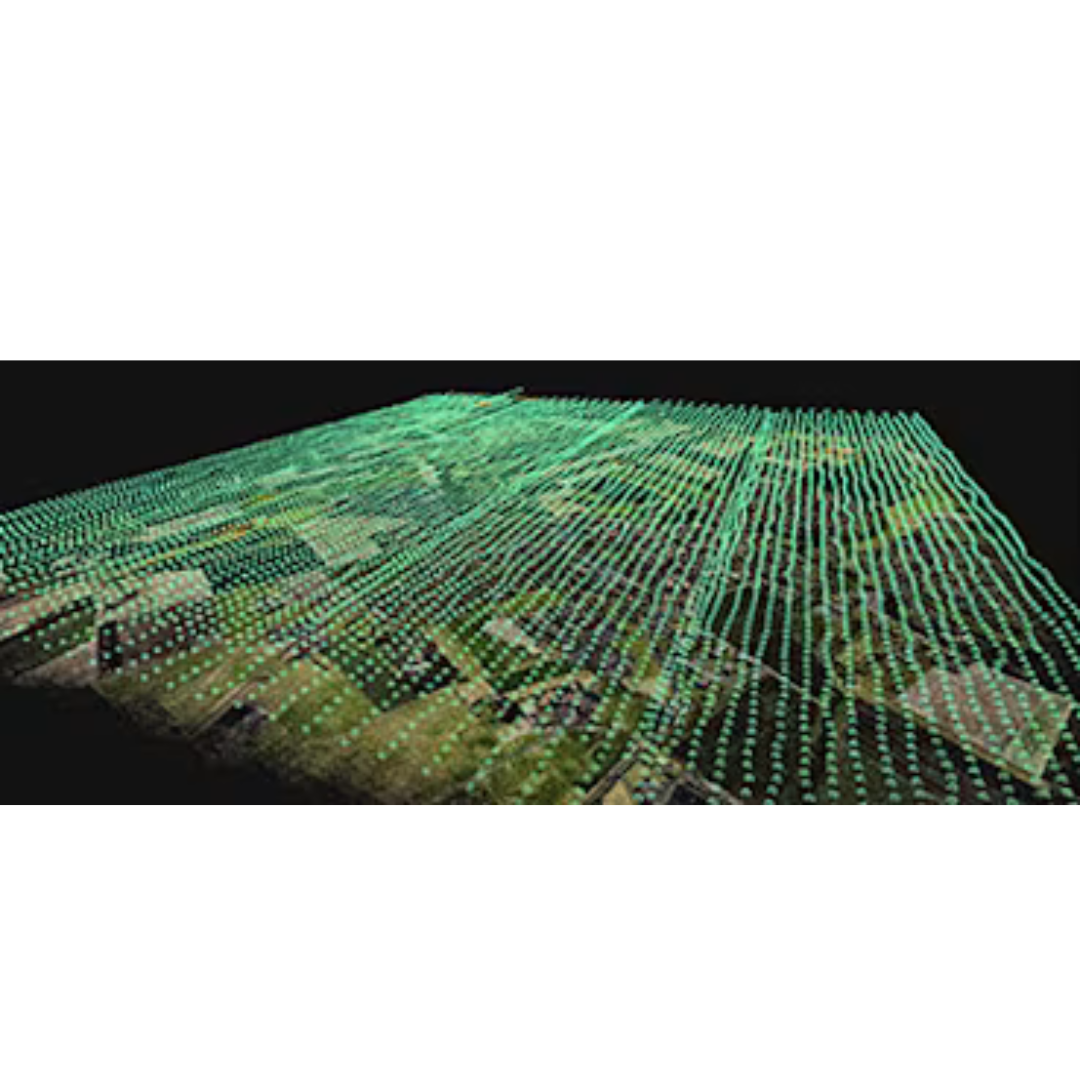
PIX4Dmatic is the next-generation photogrammetry software for professional mapping. It handles large-scale projects with ease and speed. Specifically, this software processes thousands of images without compromising accuracy. You can now manage your entire workflow on your local machine. This ensures maximum privacy and data security. Consequently, professionals in surveying and AEC trust this tool for high-stakes projects. It bridges the gap between raw data and actionable insights efficiently.
Key Features
The software offers a unique fusion of technologies. You can leverage both photogrammetry and terrestrial LiDAR data in one platform. Therefore, you get the best of both worlds in your 3D models. This combination improves the density and accuracy of your point clouds. Additionally, PIX4Dmatic optimizes your processing time significantly. It uses powerful algorithms to handle massive datasets faster than ever before. You maintain full control over every processing step. Furthermore, the intuitive interface simplifies complex mapping tasks. You can easily switch between different data sources. As a result, your team becomes more productive and focused.
Specifications
This software supports a wide range of hardware and data formats. It works seamlessly with professional drones and terrestrial scanners. Moreover, you can export CAD-ready deliverables directly from the application. The software generates high-resolution orthomosaics and digital surface models. It also produces dense 3D point clouds for precise measurements. Notably, the system requirements are optimized for modern workstations. You get stable performance even with large file sizes. Similarly, the software supports various coordinate systems for global accuracy. This ensures your data remains consistent across different platforms.
Applications
PIX4Dmatic is ideal for various industrial applications. For instance, urban planners use it to create detailed 3D city models. Surveyors rely on it for large-scale topographic maps. Furthermore, construction managers track project progress with high precision. It is also perfect for corridor mapping and infrastructure inspections. Indeed, the ability to create CAD-ready files speeds up the design process. You can provide your clients with accurate and professional results every time. Consequently, this software is a vital asset for any modern mapping toolkit. It empowers you to tackle the most demanding geospatial challenges.
Additional Information
| Type | Analyst, Standard, Pro |
|---|---|
| Plan | Monthly, Yearly, 3 Years |
Similar Products

PIX4Dmapper Educational License
₹90,580.00 excl. GST($1,000.00)Yearly Plan.Actual value may vary depending on USD to INR exchange rate.License will be issued within 3–5 working days.
PIX4Dreact Educational Licenses
₹22,645.00 excl. GST($250.00)Yearly Plan.Actual value may vary depending on USD to INR exchange rate.License will be issued within 3–5 working days.
PIX4Dfields Educational License
₹58,877.00 excl. GST($650.00)Yearly Plan.Actual value may vary depending on USD to INR exchange rate.License will be issued within 3–5 working days.
PIX4Dcloud Educational Licenses
₹81,522.00 excl. GST($900.00)Yearly Plan.Actual value may vary depending on USD to INR exchange rate.License will be issued within 3–5 working days.
PIX4Dmatic Educational Licenses
₹99,638.00 excl. GST($1,100.00)Yearly Plan.Actual value may vary depending on USD to INR exchange rate.License will be issued within 3–5 working days.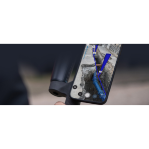
PIX4Dcatch: Transforms Smartphone or Tablet Into a Professional-Grade Surveying Tool
Price range: ₹144,022.20 through ₹550,726.40 excl. GSTSelect options This product has multiple variants. The options may be chosen on the product page Quick View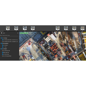
PIX4Dcloud: Web-Based Platform for Processing, Hosting, and Sharing Drone/Terrestrial Imagery
Price range: ₹116,848.20 through ₹406,704.20 excl. GSTSelect options This product has multiple variants. The options may be chosen on the product page Quick View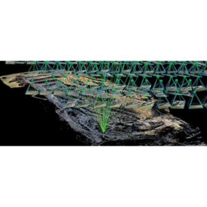
PIX4Dmapper: Industry-Standard Photogrammetry Software
₹361,414.20 excl. GST($3,990.00)Yearly Plan.Actual value may vary depending on USD to INR exchange rate.License will be issued within 3–5 working days.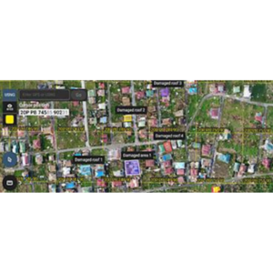
PIX4Dreact: High-Speed 2D Mapping Software
₹89,674.20 excl. GST($990.00)Yearly Plan.Actual value may vary depending on USD to INR exchange rate.License will be issued within 3–5 working days.